City Council End of Year Round Up; Kingsbridge Armory Approved; Midtown Zoning Disapproved

New York City: Largest Ice Sport Center Approved in the Bronx.

Image credit:

On December 10, 2013, the City Council voted 48-1 to turn the Kingsbridge Armory, currently a vacant landmark, into an ice sports center. The $275 million development project by KNIC Partners, LLC will feature nine ice rinks and approximately 64,300 sq. ft. of related program space, including a wellness and off-ice training center, curling rinks, and locker and equipment storage. The … <Read More>


City Planning’s Carol Samol on Redevelopment in the Bronx and Reforming the City’s Land Use Review Process

As director of the Department of City Planning’s Bronx Office, Carol Samol uses zoning tools to promote sustainable economic development in the Bronx. She has also participated as a leader in a broader City effort to reform the City’s Uniform Land Use Review Procedure’s pre-certification process.

Journey to the Bronx. Samol grew up in the upper Ohio Valley near Wheeling, West Virginia and studied English at Berea College, a small liberal arts college in Kentucky. … <Read More>


Brooklyn’s Special 4th Avenue District approved

Special district created to eliminate blank walls and curb cuts and promote pedestrian uses. On November 29, 2011, the City Council approved the Department of City Planning’s proposal to establish the Special 4th Avenue Enhanced Commercial District in Brooklyn. The special district encompasses portions of 56 blocks along 4th Avenue between Atlantic Avenue and 24th Street in Brooklyn’s Park Slope and South Park Slope neighborhoods.

The 4th Avenue commercial corridor was historically characterized by … <Read More>


Planning unveils online land use and zoning tool

Mapping tool provides range of zoning and land use information for individual properties and City at large. On August 25, 2011, the Department of City Planning and the Department of Information Technology & Telecommunications announced the release of the publicly accessible zoning and land use web application known as as ZoLa. The web-based Geographic Information Systems tool provides up-to-date maps with zoning and land use information for New York City properties.

ZoLa is a part … <Read More>


Thirteen-story building near Fordham approved

Developer obtained rezoning in order to build a ten-story tower on top of a three-story medical facility currently under construction. On June 29, 2010, the City Council approved Sean Daneshvar’s rezoning proposal to facilitate the development of a thirteen-story building at 621 East Fordham Road in the Belmont section of the Bronx. The site is occupied by a one-story medical facility that Daneshvar is currently enlarging to three stories pursuant to a BSA variance. The … <Read More>


Height limits for Astoria considered

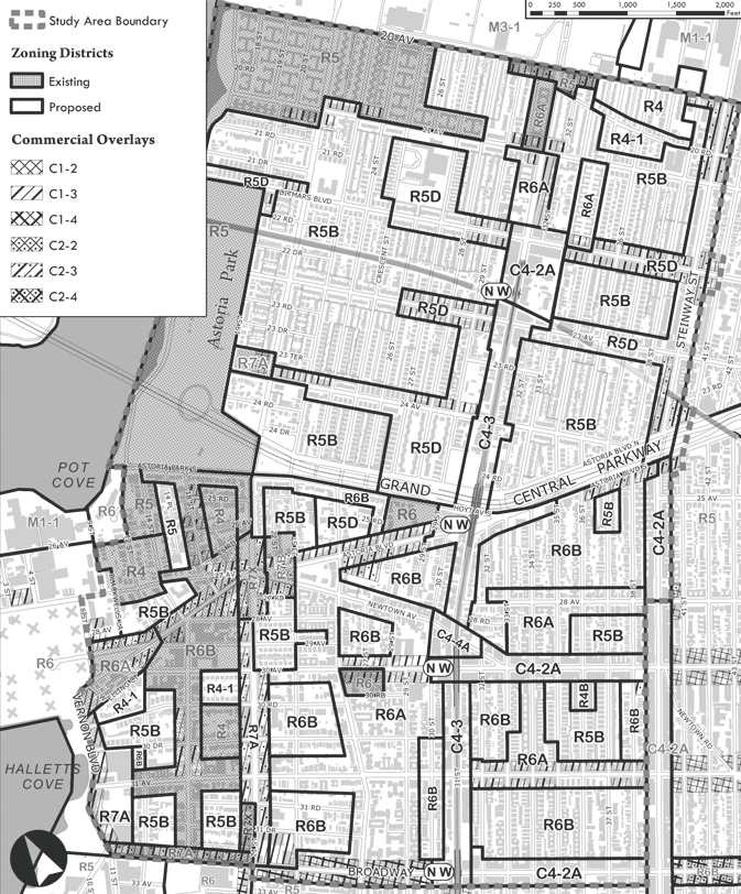
Proposed Astoria rezoning map used with permission of the New York City Department of City Planning. All rights reserved.

Local Council Member and residents supported the proposed 248-block contextual rezoning, but two property owners requested modifications. On March 24, 2010, the City Planning Commission heard testimony on the Department of City Planning’s contextual rezoning plan for Astoria, Queens. The 248-block study area is generally bounded by 20th Avenue to the north, Broadway to the south, … <Read More>