Brooklyn’s Special 4th Avenue District approved

Special district created to eliminate blank walls and curb cuts and promote pedestrian uses. On November 29, 2011, the City Council approved the Department of City Planning’s proposal to establish the Special 4th Avenue Enhanced Commercial District in Brooklyn. The special district encompasses portions of 56 blocks along 4th Avenue between Atlantic Avenue and 24th Street in Brooklyn’s Park Slope and South Park Slope neighborhoods.

The 4th Avenue commercial corridor was historically characterized by … <Read More>


Planning unveils online land use and zoning tool

Mapping tool provides range of zoning and land use information for individual properties and City at large. On August 25, 2011, the Department of City Planning and the Department of Information Technology & Telecommunications announced the release of the publicly accessible zoning and land use web application known as as ZoLa. The web-based Geographic Information Systems tool provides up-to-date maps with zoning and land use information for New York City properties.

ZoLa is a part … <Read More>


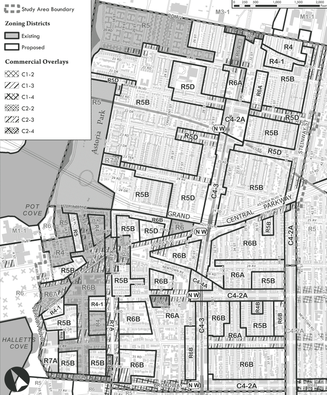
Height limits for Astoria considered

Proposed Astoria rezoning map used with permission of the New York City Department of City Planning. All rights reserved.

Local Council Member and residents supported the proposed 248-block contextual rezoning, but two property owners requested modifications. On March 24, 2010, the City Planning Commission heard testimony on the Department of City Planning’s contextual rezoning plan for Astoria, Queens. The 248-block study area is generally bounded by 20th Avenue to the north, Broadway to the south, … <Read More>