The Briarwood Organization requested a rezoning in order to expand offices on adjoining property. On October 14, 2009, the City Council approved the Briarwood Organization LLC’s proposal to extend a C2- 2 commercial overlay within an existing R4 district on Bell Boulevard between 36th and 38th Avenues in Bayside, Queens. The C2-2 overlay had previously extended 200 feet north of the intersection of Bell Boulevard and 38th Avenue, stopping at a two-story building at 36-35 Bell Boulevard that is occupied by Briarwood’s offices. The underlying R4 district does not permit commercial and office uses, and Briarwood requested the rezoning in order to expand its offices by building an attached four-story structure north of its existing building on property currently owned by Redeemer Lutheran Church.
Briarwood originally proposed extending the C2-2 overlay’s boundary 300 feet north to the corner of Bell Boulevard and 36th Avenue. During its review of the application, however, the City Planning Commission limited the overlay extension to 50 feet. The Commission noted that this would be sufficient to allow Briarwood to develop its planned office and community facility building on the adjacent lots. (read more…)

- City Island Estates’ proposed residential development on City Island. Image: Courtesy of Lessard Group Architects.
Developer sought height waiver for proposed development abutting Long Island Sound. On October 14, 2009, the City Council approved City Island Estates’ proposal to build a residential development abutting the eastern shore of Long Island Sound at 226 Fordham Place on City Island. The 43-unit project includes 21 two-family, side-by-side, detached residences and one single-family, detached home. Five of the houses will front Fordham Place, and the developer will build the remaining seventeen homes behind Fordham Place along a private internal road accessible from Fordham Street. On the site’s northeast boundary, the developer will also build a promenade with publicly accessible seating and open space.
The developer requested a waiver of the Special City Island District’s 35-foot height requirement in order to build seventeen of the residences up to 41.5 feet in height. It claimed that because these homes would be located within a floodplain on land sloping toward the sound, it could not provide ground floor living space. With the waiver, the developer could instead provide living space on the second and third floors and use the ground floor for garage space. The developer also proposed rezoning the site and an adjacent lot from M1-1 to R3A. (read more…)
FRESH program would create incentives to encourage developing full-line grocery stores in underserved neighborhoods. On October 26, 2009, the City Council’s Zoning & Franchises Subcommittee heard testimony on the City’s proposed Food Retail Expansion to Support Health (FRESH) program. The program would provide zoning and financial incentives to encourage grocerystores in neighborhoods identified in a 2008 study as being underserved by stores offering a full range of fresh food. These neighborhoods are located primarily in northern Manhattan, southern Bronx, central Brooklyn, and areas of Queens.
The program would apply to manufacturing and commercial districts within the underserved communities. Stores qualifying for benefits would be required to provide at least 6,000 sq.ft. of space for food and non-food products, and at least 2,000 sq.ft. or 30 percent of space, whichever is greater, for perishable goods. Currently, grocery stores up to 10,000 sq.ft. are permitted in M1 districts, but under the proposal stores up to 30,000 sq.ft. would be permitted as-of-right. (read more…)

- New mixed-use development at 470 Vanderbilt Avenue. Image: Courtesy Goldstein Hill & West Architects/ Costas Kondylis & Partners.
Project will provide 376 residential units, 616,555 sq.ft. of commercial floor area, and up to 397 underground parking spaces. The City Council approved GFI Development Company’s proposal to build a new 12-story mixed-use building and expand and renovate an existing 10- story loft building located on a full block bounded by Fulton Street and Vanderbilt, Atlantic, and Clermont Avenues in Brooklyn’s Fort Greene neighborhood. The loft building is mostly vacant, containing only limited telecommunications uses.
GFI will convert the loft building’s ground floor to retail space and fill in its interior courtyards to increase available commercial space. The new mixed-use building will replace an accessory surface parking lot and provide 376 residential units, 85 of which will be affordable. The new building will have a 69- foot base height along Fulton Street and will rise to a mid-block height of 133 feet through a series of setbacks. It will also provide 32,358 sq.ft. of ground floor retail space and a two-story, 397-space accessory parking garage below the new building. (read more…)

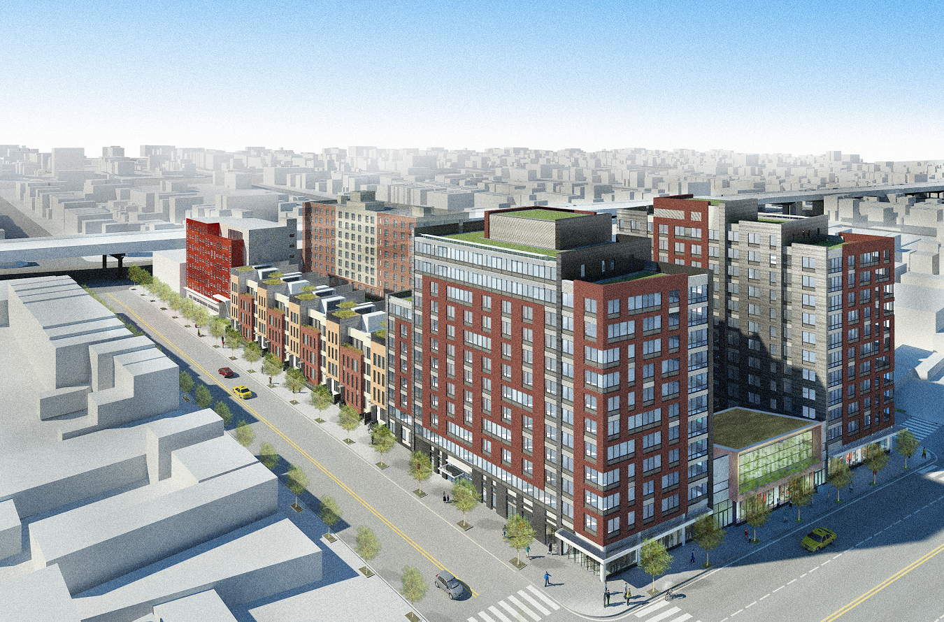
- Mixed-use development near Brooklyn Navy Yard. Image: Courtesy FXFOWLE Architects.

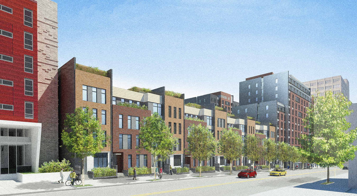
- Proposed Navy Green development along Vanderbilt Avenue between Flushing and Park Avenues. Image: Courtesy FXFOWLE Architects.
Located on former prison site, the complex will provide affordable and special needs housing. On September 30, 2009, the City Council approved the Department of Housing Preservation and Development’s proposal to facilitate the construction of a 455- unit complex, known as Navy Green, in Brooklyn’s Wallabout neighborhood. The 461,449 sq.ft. mixed-use development will be located on most of the block bounded by Flushing Avenue to the north, the Brooklyn- Queens Expressway to the south, Vanderbilt Avenue to the east, and Clermont Avenue to the west. During World War II, the Navy operated a prison on the site and the City’s Department of Correction used the structure before its 2005 demolition.
Dunn Development and L&M Development Partners’ proposal for the site includes four multi-family buildings and 23 four-story townhouses. The developers will build two 12-story structures on Flushing Avenue that will step down to eight-stories as they wrap around the corners of Clermont and Vanderbilt Avenues, respectively. The plan calls for constructing 10 four-story townhouses along Clermont Avenue, and 13 townhouses on Vanderbilt Avenue. An eight-story structure will be built on the southern portion of Clermont Avenue, and another eight-story building will be located along the southern portion of Vanderbilt Avenue. This building will provide 95-units of housing for low-income singles and special needs housing, targeting formerly homeless adults who suffer from mental illness. (read more…)
Community groups expressed concern that 128-block rezoning would displace low-income residents. On September 30, 2009, the City Council approved the Department of City Planning’s proposal to rezone 128 blocks of Brooklyn’s Sunset Park in order to address recent out-of-scale development inconsistent with the area’s predominantly residential character. The plan replaces the neighborhood’s R6 zoning with contextual zoning districts — R4A, R4-1, R6B, R6A, and R7A — that match the area’s context and also establish maximum height limits. The plan includes applying R6B zoning to portions of 121 residential side streets and rezoning 101 partial commercial blocks along Fourth and Seventh Avenues to R7A. To promote the construction of affordable housing, the City’s Inclusionary Housing Program will apply to the R7A district.
At the City Planning Commission’s July 1 hearing, representatives of the Sunset Park Alliance of Neighbors (SPAN) testified in opposition. They claimed that Planning did not properly consider the potential displacement of current residents. Residents argued that height limits along the avenues were too high and would block views of downtown Brooklyn. The Commission approved the plan without modifications, noting that it had been refined through a thorough public review. 6 CityLand 122 (Sept. 15, 2009). (read more…)