New York City has a long and rich history of scandal and corruption. Here are three examples from favorite books that visit past scandals in complete and revealing detail.
Search Results for: Coney Island, Brooklyn
Thirty of 95 backlogged items prioritized for 2016 designation votes

Some items will be removed from calendar due to political reality that designations will not be ratified by Council; others are found to be adequately protected so as to not require prioritization; others to lack significance that would merit immediate designation. On February 23, 2016, Landmarks made determinations on the disposition of 95 items added to Landmarks’ calendar before 2010, but never subjected to a vote on designation. In 2015 the commission had announced … <Read More>
Commission Held First of Four Special Hearings to Address Backlog
Wide support voiced for designation of Coney Island pumping Station; potential extension to Douglaston Historic District and individual designation of Queens Apartment complex and religious structures proved contentious. On October 8, 2015, the Landmarks Preservation Commission held the first of four hearings meant to address the backlog of items on the Commission’s calendar added prior to 2010. Twenty-nine items were considered, in three groupings of multiple items clustered by borough. Each speaker had three minutes … <Read More>
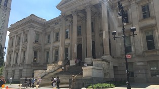
Council Member Brad Lander on Current Initiatives Affecting Land Use in the City
Council Member Brad Lander, chair of the City Council’s Landmarks, Public Siting & Maritime Uses Subcommittee, draws from his experience as a public policy advocate when executing his duties.
Originally from St. Louis, Missouri, Lander in 1991 earned a liberal arts degree from the University of Chicago. He then earned a master’s degree in Social Anthropology at the University College London in the United Kingdom, where he worked with community groups to research how a … <Read More>
Council approves protective Flatbush rezoning
Plan seeks to protect Victorian homes and pre-war apartment buildings. The City Council approved the Department of City Planning’s rezoning proposal for the Flatbush neighborhoods south of Brooklyn’s Prospect Park. The plan impacts 180 blocks generally bounded by Prospect Park to the north, Bedford Avenue to the east, Coney Island Avenue to the west, and Brooklyn College to the south. The rezoning area includes the Prospect Park South, Ditmas Park, Albermarle- Kenmore Terraces, and Fiske … <Read More>
Proposed Brighton Beach rezoning criticized

- Brighton Beach Rezoning: Proposed Zoning used with permission of the New York City Department of City Planning. All rights reserved.

Planning’s recommendation to downzone bungalow area opposed. On May 6, 2009, the City Planning Commission listened to extensive testimony on the Department of City Planning’s rezoning proposal for Brooklyn’s Brighton Beach. The plan would impact 54 blocks generally bounded by Shore Parkway, Brighton Beach Avenue, Ocean Parkway, and Corbin Place.
The proposed rezoning area … <Read More>