Modifications to private rezoning application centered on encouraging affordable housing. On March 13, 2013, the City Council voted to approve Trinity Church’s Special Hudson Square District proposal with modifications. The proposal was intended to facilitate residential development and protect existing office space. Zoning & Franchises Subcommittee Chair Mark Weprin announced modifications to the proposal at a Subcommittee meeting on March 13, 2013. The modifications addressed many of the concerns expressed by community residents and … <Read More>
Search Results for: Open Streets
Community Concerns Voiced at City Council Hearing for Special Hudson Square District
Community Board urges Trinity to build a new recreation center to accommodate projected population increase. On February 12, 2013, the City Council’s Zoning & Franchises Subcommittee held a hearing for Trinity Church’s application to rezone 18 blocks generally bounded by West Houston and Canal Streets, Avenue of the Americas, and Greenwich Street. The Special Hudson Square District will facilitate residential development, maintain commercial office space, and encourage ground-floor retail. Trinity Church owns approximately 39 … <Read More>
City Council Tweaks Six-Acre Seward Park Redevelopment Plan Proposed for Area Along Delancey Street
The City agreed to increase number of housing units from 900 to 1,000 and set aside space for on-site public school. On October 11, 2012 the City Council modified and approved the City’s Seward Park Mixed-Use Development Project. The 1.65 million-square-foot project will impact nine City-owned lots on the north and south sides of Delancey Street between Ludlow and Clinton Streets in Manhattan’s Lower East Side. The City envisions the development of six new … <Read More>
Council Denies Sidewalk Cafe Permit for Court Street Restaurant
City Council reacted to application’s inaccurate architectural renderings and restaurant’s history of noise complaints. On August 22, 2012, the City Council denied Buschenschank restaurant’s application for an unenclosed sidewalk cafe at 320 Court Street between Degraw and Sackett Streets in Carroll Gardens, Brooklyn. The application called for 24 tables and 48 chairs fronting Court Street.
At the Council’s Zoning & Franchises Subcommittee hearing, a representative of local Council Member Brad Lander and a representative … <Read More>
Ten-building project approved in Central Bronx
Proposed 1,300-unit project near the Bronx River led by Gifford Miller would include a mix of affordable and market-rate apartments. On October 5, 2011, the City Council approved Signature Urban Properties’ proposal to build a ten-building mixed-use project overlooking the Sheridan Expressway and the Bronx River in the Crotona Park East and West Farms sections of the Bronx. To facilitate the approximately 1,300- unit project, Signature submitted … <Read More>
Key Terms text change OK’d
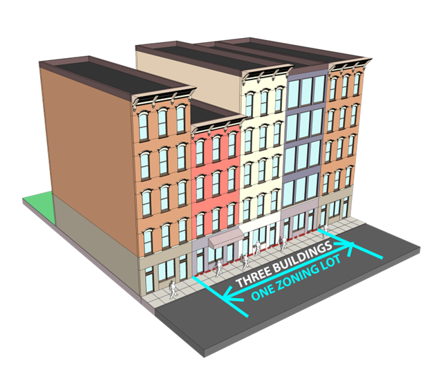
Amendment redefines “development” and “building” and clarifies how the terms are used in order to reflect Planning’s intent. On February 2, 2011, the City Council approved the Department of City Planning’s Key Terms Text Amendment. Planning proposed the 700-page text amendment to ensure that existing regulations are interpreted and applied as originally intended under the … <Read More>


