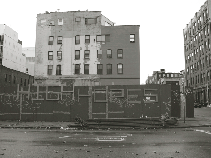
Willets Point Boulevard, near 38th Avenue, in Queens. Photo: CityLand.
City chose not to heavily invest in Willets Point infrastructure. In November 2008, the City Council approved a $3 billion development plan for Willets Point, an industrial neighborhood in northern Queens. When implemented, the plan would transform the low-end commercial area into a mixed-use community with residential, retail, hotel, and entertainment uses. Under the plan, the City could utilize eminent domain to acquire property needed for development. The Willets Point Industry and Realty Association, an organization of local businesses, sued the City. The Association argued that the City violated its equal protection rights by choosing not to provide services and infrastructure in Willets Point over the last 40 years. The Association claimed that this decision was an attempt to reduce property values so that the City could more easily justify the use of eminent domain and could acquire properties for lower prices. The 2008 development plan, according to the Association, was the City’s latest attempt to reduce property values.
District Court Judge Edward R. Korman dismissed the Association’s lawsuit. Judge Korman ruled that the Association’s equal protection claim had no merit because the City had a rational basis for not spending money or other resources in Willets Point until a comprehensive redevelopment plan was finalized. The unique conditions of Willets Point, including an oddly designed street system and unusual soil composition, led City officials to conclude that greater investment in the area could not be rationally justified unless the area was redeveloped for non-industrial uses. (read more…)
The Briarwood Organization requested a rezoning in order to expand offices on adjoining property. On October 14, 2009, the City Council approved the Briarwood Organization LLC’s proposal to extend a C2- 2 commercial overlay within an existing R4 district on Bell Boulevard between 36th and 38th Avenues in Bayside, Queens. The C2-2 overlay had previously extended 200 feet north of the intersection of Bell Boulevard and 38th Avenue, stopping at a two-story building at 36-35 Bell Boulevard that is occupied by Briarwood’s offices. The underlying R4 district does not permit commercial and office uses, and Briarwood requested the rezoning in order to expand its offices by building an attached four-story structure north of its existing building on property currently owned by Redeemer Lutheran Church.
Briarwood originally proposed extending the C2-2 overlay’s boundary 300 feet north to the corner of Bell Boulevard and 36th Avenue. During its review of the application, however, the City Planning Commission limited the overlay extension to 50 feet. The Commission noted that this would be sufficient to allow Briarwood to develop its planned office and community facility building on the adjacent lots. (read more…)
Carroll Gardens and Columbia Street neighborhoods rezoned to prevent out-of-scale development. On October 28, 2009, the City Council approved the Department of City Planning’s rezoning proposal for 86 blocks in Brooklyn’s Carroll Gardens and Columbia Street neighborhoods. The approved plan replaces the area’s R6 zoning with contextual districts in order to establish height limits to preserve the neighborhoods’ existing built character. The area is characterized by three- to four-story rowhouses with some four- to five-story multi-family apartment buildings. Recent development has resulted in buildings that are out-of-scale with the area’s low-rise context. 6 CityLand 120 (Sept. 15, 2009).
The plan rezones 76 full or partial blocks to R6B, establishing maximum building heights of 50 feet for many residential east-west blocks. It applies R6A regulations along the wide, mixed-use corridors of Court and Columbia Streets and on narrow streets characterized by taller, bulkier buildings. The approved proposal rezones a one-block portion along Tiffany Place to R7A, reflecting the block’s existing seven-story buildings. Commercial overlays along Smith, Court, and Columbia Streets have been adjusted to allow an expanded range of uses and to prevent encroachment into the residential side streets. (read more…)

- City Island Estates’ proposed residential development on City Island. Image: Courtesy of Lessard Group Architects.
Developer sought height waiver for proposed development abutting Long Island Sound. On October 14, 2009, the City Council approved City Island Estates’ proposal to build a residential development abutting the eastern shore of Long Island Sound at 226 Fordham Place on City Island. The 43-unit project includes 21 two-family, side-by-side, detached residences and one single-family, detached home. Five of the houses will front Fordham Place, and the developer will build the remaining seventeen homes behind Fordham Place along a private internal road accessible from Fordham Street. On the site’s northeast boundary, the developer will also build a promenade with publicly accessible seating and open space.
The developer requested a waiver of the Special City Island District’s 35-foot height requirement in order to build seventeen of the residences up to 41.5 feet in height. It claimed that because these homes would be located within a floodplain on land sloping toward the sound, it could not provide ground floor living space. With the waiver, the developer could instead provide living space on the second and third floors and use the ground floor for garage space. The developer also proposed rezoning the site and an adjacent lot from M1-1 to R3A. (read more…)

- A stalled construction site at 150 North 12th Street in Williamsburg, Brooklyn. Photo: CityLand
Owners of stalled sites participating in new DOB safety monitoring program can renew permits for up to four years. On October 14, 2009, the City Council passed legislation creating a construction site maintenance program, to be administered by the Department of Buildings, for sites where permitted work has been suspended or has not commenced.
Currently, construction permits issued by Buildings will expire if the owner does not commence work within twelve months or suspends work for a period of twelve months. Owners must then request that Buildings reinstate the permits before restarting work. An owner suspending work for more than two years risks losing the ability to reinstate the permits. Under the new program, permits held by participating owners of stalled sites would remain valid for the full two-year term, and Buildings could renew the permits for up to four years, as long as the owner remained in good standing. (read more…)
Council refused Hines’s request to restore the 200 feet cut from the proposed MoMA tower. On October 14, 2009, the City Council approved a modified version of Hines Interests’ proposal to build a mixed-use tower adjacent to the Museum of Modern Art complex at 53 West 53rd Street in Midtown, Manhattan. The original proposal called for an 85-story, 1,250-foot tower that would include 51,949 sq.ft. of additional gallery space for MoMA, a 147,965 sq.ft. hotel, and 458,412 sq.ft. of residential floor area. In order to build the project, Hines requested approval to transfer a combined 411,000 sq.ft. of development rights from the landmarked University Club and St. Thomas Church.
At the City Planning Commission’s July 22 hearing, opponents expressed concerns about the project’s impact on the neighborhood, arguing the tower was inappropriate for the site’s mid-block location. The Commission approved the project, but it reduced the tower’s height by 200 feet, noting that the building did not merit reaching the height of the Empire State Building, the City’s tallest building. 6 CityLand 138 (Oct. 15, 2009). (read more…)