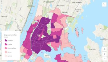
The tool aims to aid discussions and policymaking for creating affordable housing and preventing displacement. On February 22, 2022, the Department of City Planning (DCP) and the Department of Housing Preservation and Development announced the beginning of public engagement work for a new interactive tool, the Equitable Development Data Tool. The tool will allow users to examine housing, demographics, public health and other data, and compare that data across neighborhoods and racial and ethnic … <Read More>
Department Of City Planning
DCP Announces New Comprehensive Waterfront Plan
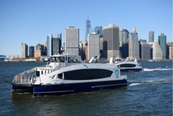
A new plan is released every ten years. On December 19, 2021, the Department of City Planning released the Comprehensive Waterfront Plan, a 10-year vision for the 520 miles of waterfront citywide. The plan aims to provide more equitable access to waterfronts.
DCP Launches Capital Planning Explorer Website
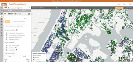
On December 20, 2021, the Department of City Planning announced the release of the new Capital Planning Explorer, an interactive website that builds on an existing map of city facilities with added details about all City-funded capital projects and geographic views of housing permits. The website’s goal is to make capital planning more transparent.
DCP’s Population FactFinder Relaunched with Updated 2020 Census Data

On November 4, 2021, the Department of City Planning announced the relaunch of its Population FactFinder, an interactive website that provides demographic data about New York City. The website has been updated with the data collected from the 2020 census.
City’s POPS Reopen after COVID Restrictions Lifted
The spaces were closed to prevent the spread of COVID. As of July 1st, the Department of City Planning announced that all Privately Owned Public Spaces (POPS) have reopened to the public. POPS are public spaces owned and maintained by private property owners under various zoning regulations at no cost to the City. There are nearly 600 POPS in existence today, in the forms of indoor and outdoor atriums, plazas, walkways, and other … <Read More>
City Planning Launches Open House Webpage for Public Engagement with Four Future Bronx Metro-North Stations
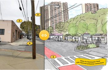
The Department’s ongoing study uses community feedback to assess land use needs in the East Bronx. On April 30, 2021, the Department of City Planning released a new public engagement website for four new future Metro-North train stations in the east Bronx. The Metro-North Stations are planned for the Hunts Point, Parkchester/Van Nest, Morris Park and Co-Op City neighborhoods and will connect with Penn Station and locations further north. Currently, there is information for the … <Read More>