Independence Day commemorates the United States’ declaration of independence from Great Britain. Significant events occurred in New York City during the Revolutionary War, and many historic figures were from, and are buried here. In celebration of Independence Day, CityLand has created a list of some historic landmarks designated by the Landmarks Preservation Commission that have a connection to the Revolutionary War era. Happy 4th of July from all of us here at the Center for … <Read More>
Search Results for: Morris Park, Bronx
Yankee Stadium area rezoning approved
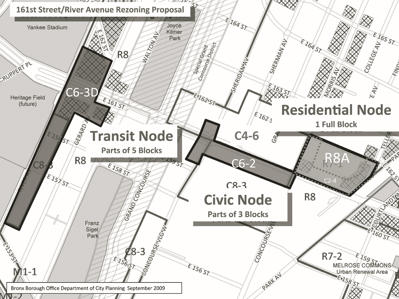
Approved plan rezones 161st Street and River Avenue corridor and establishes new C6-3D commercial zoning district. On September 30, 2009, the City Council approved the Department of City Planning’s proposal to rezone areas along 161st Street and River Avenue in southwest Bronx. The rezoning impacts portions of eight blocks in three separate areas within the heart of the borough’s civic center, described as the Residential, Civic, and Transit Nodes. The … <Read More>
Lower Concourse plan OK’d
Plan envisions public walkway along Harlem River waterfront. The Department of City Planning’s sweeping rezoning proposal for a 30-block area of the South Bronx, bordering the Harlem River, obtained City Council approval on June 30, 2009. The plan impacts the underused and primarily industrial-zoned area along the Harlem River, bounded by East 149th Street … <Read More>
Lower Concourse Rezoning at scoping stage
Thirty-block rezoning in South Bronx would encourage redevelopment of blighted waterfront. On June 19, 2008, the Department of City Planning held a public hearing on the draft scope of an environmental impact statement for the proposed Lower Concourse Rezoning. The proposal covers a 30-block area, generally bounded by the Harlem River on the west, East 149th to … <Read More>
New bridge for East 153rd Street approved
Bridge will provide four traffic lanes, two bike paths, two walkways and a needed cross-town connection. The Department of Transportation sought a City Map amendment for the construction of a new East 153rd Street bridge in the Bronx to span the Metro North railroad tracks and reconnect the east-west linkage of East 153rd, between Morris Avenue and the Grand Concourse. DOT closed the original 1899 two-lane bridge in 1988, due to safety concerns, and demolished … <Read More>
Mixed-use antique district expanded
129-lot area rezoned to permit residential, live-work and retail. The Planning Commission approved the proposed rezoning of a 129-lot area of Port Morris in the South Bronx that altered the area’s manufacturing zoning to mixed-use, facilitating increased live-work, residential and small commercial business development. The proposed new zoning builds on a 1997 zoning action that established the Port Morris Special Mixed-Use District – the city’s first mixed-use district – within a five-block area of Port … <Read More>


